

Home » Free Printables » Printable Maps » Oklahoma
Printable Oklahoma Map Collection
County Map - City Map - State Outline Map
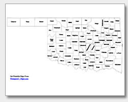
Oklahoma County Map with County Names
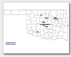
Map of Oklahoma Cities with City Names
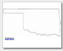
Oklahoma State Outline Map
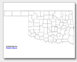
Blank Oklahoma County Map
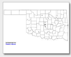
Blank Oklahoma City Map
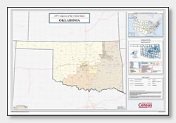
Oklahoma Congressional District Map
(114th Congress)
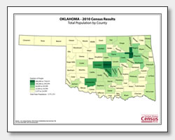
Oklahoma County Population Map
(2010 Census)
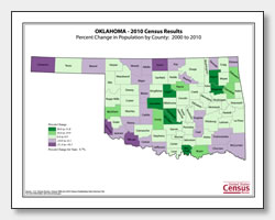
Oklahoma County Population Change Map
(2000 to 2010 Census)
ADVERTISEMENT

Click the map or the button above to print a colorful copy of our Oklahoma County Map. Use it as a teaching/learning tool, as a desk reference, or an item on your bulletin board.
Here you will find a nice selection of free printable Oklahoma maps. They include: a state outline map of Oklahoma, two county maps (one with the county names listed and the other without), and two major city maps. One of the major city maps lists the ten cities: Enid, Stillwater, Tulsa, Broken Arrow, Midwest City, Norman, Edmond, Moore, Lawton and the state capital, Oklahoma City. The other city map has dots marking the location of the cities. These maps are great for quizzes or practice. All maps are .pdf files and can be easily downloaded and printed on almost any printer. You will find all of our maps helpful tools in the classroom, office or home!